Northern Arizona · September 1, 2026 · By Shannon Roberts
When Do Fall Colors Peak in Flagstaff? A Local’s Northern Arizona Guide
A local guide to when fall colors peak in Flagstaff and Northern Arizona, with current access notes for Aspen Corner, Lockett Meadow, Oak Creek Canyon and the Grand Canyon North Rim.
Last updated September 28, 2026
Updated September 28, 2026: Lockett Meadow Road remains closed to vehicles, hikers and cyclists through November 30. Most Oak Creek sites are open. West Fork Trail No. 108 and its drainage are closed through October 31, 2026, unless the new order is rescinded. Call of the Canyon still shows a separate closure through September 30; check for a new order before planning a visit. Slide Rock’s swim area is open. The park’s current page no longer carries its September 17 stay-out-of-water recommendation. Swimming is at your own risk, with no lifeguard; check current conditions.
Official sources checked September 28: West Fork extended order · five-trail Pocket Fire order · Call of the Canyon status · Slide Rock State Park
Arizona has real fall color. It is just less interested in following your calendar than New England is.
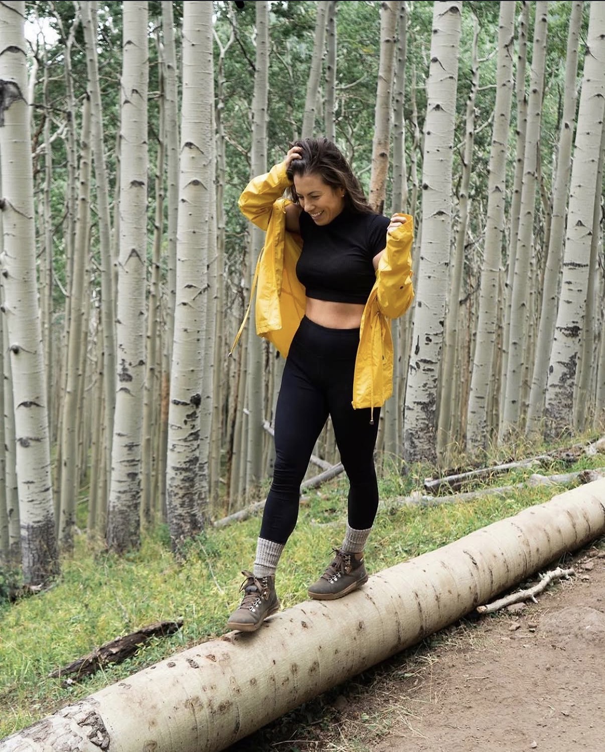
I live in Flagstaff and have chased these aspens across the San Francisco Peaks, Lockett Meadow, Hart Prairie, Aspen Corner, the Snowbowl trails, Oak Creek Canyon, and the Kaibab Plateau. The most useful thing I can tell you is this: do not plan Northern Arizona fall colors around one supposedly perfect weekend. Follow elevation.
High country can begin changing while Flagstaff is still green. A storm can strip one grove while a protected slope ten minutes away is still glowing. Oak Creek Canyon may be getting started after the highest aspens have already dropped their leaves. Fall here moves downhill in waves, with wind, freezes, temperature, moisture, and elevation rewriting the schedule every year.
This guide gives you the normal progression, the places I actually recommend, and the 2026 access details that matter. For the simplest current answer, check the Flagstaff LEAF-ometer shortly before you leave. A screenshot from last Tuesday is not a weather system.
Quick answer: When do fall colors peak in Flagstaff?
Highest elevations and Kaibab Plateau: Color may begin in late September and often performs from late September into early October. San Francisco Peaks, Snowbowl Road and upper Flagstaff slopes: Early October is a common target, sometimes extending into mid-October. Flagstaff around 7,000 feet: Early to mid-October is typical, with in-town trees sometimes holding later. Oak Creek Canyon and lower Sedona-area elevations: Color often arrives later, from mid-October into late October or early November. Important: These are planning windows, not reservations. Wind, hard freezes, storms, heat, and moisture can move or shorten peak color.
If you are booking travel, choose a window rather than one date and give yourself access to more than one elevation. That flexibility is the difference between a fall-color trip and an expensive argument with a tree.
How fall color moves through Northern Arizona
Northern Arizona does not change all at once. The first visible shift usually happens in higher, colder places: the Kaibab Plateau, the upper San Francisco Peaks, and exposed aspen stands near Snowbowl. Color then works down the mountain through Aspen Corner, the Aspen Nature Loop area, Hart Prairie, Flagstaff neighborhoods and campus, and finally into the mixed deciduous trees along Oak Creek.
Elevation matters because colder nights help trigger color. Exposure matters too. A sunny, wind-exposed grove may change and drop quickly while a sheltered drainage holds leaves longer. One early freeze can accelerate the show; one strong storm can end it. That is why locals talk about individual groves and slopes instead of declaring the entire region “at peak.”
The practical strategy is to start high, look at live reports, and keep a lower-elevation backup. If Snowbowl Road is past peak, Flagstaff may still be good. If Flagstaff is fading, Oak Creek Canyon may be entering its best stretch.
Where to see Northern Arizona fall colors, in likely order
1. Grand Canyon North Rim and the Kaibab Plateau
The Kaibab Plateau is one of the earliest places I watch. The drive crosses high forest and broad meadows where aspens can turn before central Flagstaff. It is also a long, remote trip, not a casual “we have forty minutes before dinner” detour.
For 2026, the North Rim is open with limited services after the 2025 Dragon Bravo Fire. Highway 67 and the paved scenic roads to Point Imperial and Cape Royal reopened, but there is no overnight lodging on the North Rim, no functioning public potable-water system, and several trails remain closed. The North Kaibab Trail closed after August 29 flash flooding, and status can change.
Bring the food and water you need. The normal full-service season runs through October 15; later vehicle access is weather- and road-dependent. Check the current NPS North Rim status and seasonal road guidance before committing to the drive. My Grand Canyon North Rim Travel Guide has the fuller 2026 planning picture.
2. The highest San Francisco Peaks areas
The upper slopes around Arizona Snowbowl tend to show color early because they are colder and higher. Snowbowl Road climbs from ponderosa forest into large aspen stands, and the view changes dramatically over just a few miles.
The Scenic Gondola can give you a broad look across the canopy, but operations are seasonal and weather-dependent. Do not build your entire day around a lift schedule you saw in an old reel. Check current Snowbowl hours before driving up.
At this elevation, weather can turn quickly. It may be sunny in downtown Flagstaff and windy, cold, or stormy near the upper parking lots. Bring layers even if the forecast at your hotel looks polite.
3. Aspen Corner
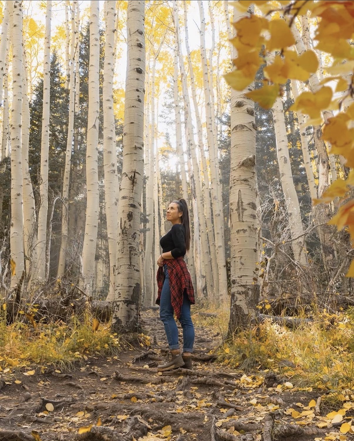
Aspen Corner is one of the easiest high-impact stops near Flagstaff. It sits along paved Snowbowl Road and puts you immediately beside a dense aspen grove. You can enjoy the color with a short walk rather than committing to a long hike.
Yes, you can drive to Aspen Corner when Snowbowl Road is open. The issue is not road difficulty; it is parking behavior. Space is limited, fall weekends get busy, and stopping partly in the roadway because the leaves are pretty remains a poor life choice. Go early on a weekday if possible, use legal parking, and keep traffic lanes clear.
4. Aspen Nature Loop near Snowbowl
The Aspen Nature Loop is one of my strongest recommendations for visitors who want a real walk through the aspens without turning the day into a summit attempt. The Forest Service describes it as a roughly 2.5-mile loop through open glades and sloping meadows.
I would call it approachable, not effortless. You are hiking around 9,000 feet on natural trail with uneven ground and some elevation change. Families who hike regularly can often do it comfortably; families with little ones can walk a shorter out-and-back section and still get the experience. The complete Flagstaff aspen-season Travel Guide goes deeper on this area.

5. Hart Prairie
Hart Prairie is where the aspens, open meadow, and San Francisco Peaks all work in the same frame. Forest Road 151 offers a scenic option for people who want color without a long hike, and it connects with longer around-the-peaks routes.
This is a gravel forest road, not a guaranteed smooth scenic byway. Dry conditions may be manageable for many passenger vehicles, but mud, ruts, maintenance, fire restrictions, and seasonal closures change that equation. Check the Coconino National Forest road-status page immediately before going. If recent rain has turned the road into pudding, your sedan does not become adventurous simply because it has Arizona plates.
6. Lockett Meadow access is fully closed in 2026
Lockett Meadow is spectacular, but it is also the place where outdated directions now cause the most trouble. The current closure is broader than the vehicle-only restriction visitors may remember from recent years.
You cannot drive, hike or bike up Forest Road 552 to Lockett Meadow in 2026. The current Forest Order prohibits being on Forest Road 552 and entering the described area around it. The closure remains in effect through November 30 unless rescinded, and Lockett Meadow Campground is listed as affected. The former six-mile road walk is not allowed. Waterline and Weatherford still connect with Inner Basin Trail, but those are long, strenuous backcountry routes—not substitutes for the normal Lockett Meadow trailhead.
This closure is for public safety during road maintenance and is separate from the earlier post-Pipeline Fire vehicle restriction. Verify the current Forest Service closure notice plus the full Coconino National Forest alerts list before you go. Read my full 2026 Lockett Meadow closure update for the access details. Do not enter the closed road or described closure area.
7. Flagstaff in town: downtown and NAU
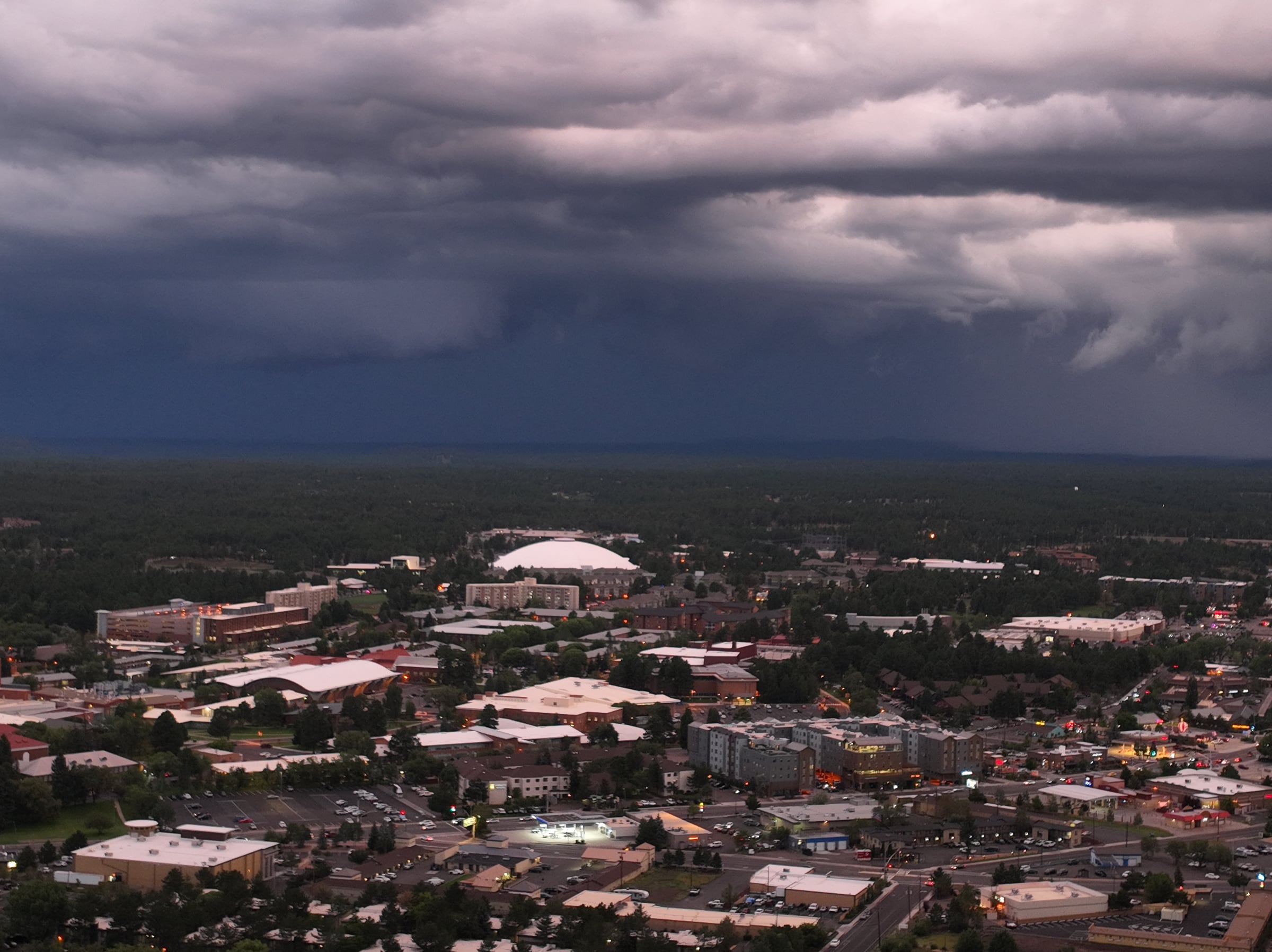
You do not need a forest road to see fall color. Downtown Flagstaff and the Northern Arizona University campus have aspens, maples, and other deciduous trees that often change after the highest slopes. These are good choices for families, visitors with limited time, or anyone whose relationship with dirt roads is strictly theoretical.
Downtown lets you combine color with coffee, shops, restaurants, and Route 66. NAU offers broad walkways and pockets of color around campus. Use The Actually Useful Guide to Flagstaff for the larger trip plan, or pair a short color walk with my guide to historic downtown Flagstaff and Route 66.
8. Oak Creek Canyon and lower Sedona elevations
Oak Creek Canyon is the late-season backup that sometimes becomes the main event. State Route 89A drops about 2,500 feet from Flagstaff toward Sedona, trading high-country aspens for creekside cottonwoods, oaks, maples, and sycamores. The color is more varied—yellow, orange, red—and it often arrives after the Peaks.
Traffic, narrow pull-offs and wet weather matter here. Most Oak Creek access reopened September 17. West Fork Trail No. 108 and its drainage are closed through October 31, 2026, unless the new order is rescinded. Call of the Canyon still shows a separate closure through September 30; check for a new order before planning a visit. Slide Rock’s swim area is open. The park’s current page no longer carries its September 17 stay-out-of-water recommendation. Swimming is at your own risk, with no lifeguard; check current conditions. Check Forest Service alerts before stopping. If you want to visit the state park, my Slide Rock guide covers the practical details; the Sedona guide helps build the rest of the day.
Best fall scenic drives near Flagstaff
You can see a great deal of color without a long hike. These are the routes I would consider first:
Snowbowl Road: The easiest paved climb into high-elevation aspen stands, with Aspen Corner and Snowbowl access along the way.
Highway 180 and Hart Prairie Road: A flexible loop with peak views, open meadow, aspens, and gravel-road sections. Check road conditions first.
State Route 89A through Oak Creek Canyon: Best later in the season, with mixed colors, canyon walls, and creekside forest. Expect curves and traffic.
Kaibab Plateau to the North Rim: A long, remote day trip through high forest. In 2026, carry water and food and verify North Rim status before leaving.
Discover Flagstaff also maintains a useful list of fall foliage drives. Use it for route ideas, then check the actual road and closure pages. Scenic-drive articles age more gracefully than forest roads do.
Easy and family-friendly options
For the least demanding fall-color day, choose Aspen Corner, a partial walk on Aspen Nature Loop, downtown Flagstaff, or NAU. Snowbowl Road also delivers a lot of scenery from the car, assuming weather and traffic cooperate.

The Aspen Nature Loop is a good family hike for children who are comfortable on natural trails at elevation. A shorter out-and-back is completely valid. Nobody receives a ceremonial leaf for making a tired six-year-old complete the loop.
For a low-walking Sedona add-on later in the season, drive Oak Creek Canyon and choose one legal, open stop. My guide to Sedona without hiking includes more ways to build the day around scenery rather than mileage.
More demanding fall-color hikes
Do not treat Lockett Meadow or the Forest Road 552 approach as a demanding hiking option in 2026; that route is closed to foot and bicycle traffic as well as vehicles. For most visitors, the practical alternative is an open trail elsewhere on the Peaks. Verify current Forest Service alerts before leaving.
Humphreys, Kachina, Abineau, Bear Jaw, and longer around-the-peaks routes can also deliver excellent color, but they require more fitness, navigation, time, and weather judgment. Check current Forest Service trail status and choose the hike for your group—not the hike that performed best on someone else’s camera roll.
2026 access and safety notes
Before leaving, check three things: the Flagstaff LEAF-ometer for color, Coconino National Forest alerts and road status for access, and the NPS North Rim status page if you are making the long drive. Lockett Meadow: Closed to vehicles, hikers and cyclists through November 30; do not use Forest Road 552 as a hike-in route. North Rim: Open with limited 2026 services; no in-park lodging, no public potable-water system, and several trail closures. Bring necessary food and water. Oak Creek: Most Oak Creek access reopened September 17. West Fork Trail and drainage remain closed through October 31; Call of the Canyon still shows a separate order through September 30. Storm runoff can make open water unsafe. Snowbowl and forest roads: Gondola schedules, storm holds, maintenance, mud, fire restrictions, and seasonal closures can change access.
Fall is beautiful and deceptively busy. Parking lots fill, shoulders become chaotic, and emergency access still matters even when everyone has collectively decided the same grove is photogenic. Arrive early, use legal parking, and have a second location.
What to wear, bring and expect
Layers: Mornings can be cold, upper elevations can be windy, and afternoon sun may feel warm.
Water and snacks: High elevation increases dehydration and fatigue. North Rim visitors in 2026 must be especially self-sufficient.
Sun protection: Northern Arizona sun remains enthusiastic in October.
Sturdy shoes: Even easy trails can be rocky, rooty, muddy, or covered with slick leaves.
Offline maps: Cell service is unreliable in forest and canyon areas.
An early start: Better parking, softer light, fewer crowds, and more time to change locations if one grove is past peak.
A road backup: Dirt roads can become muddy or rough after storms. Never drive around a closure or create a new pull-off.
Leave No Trace: what that means during fall-color season
Fall weekends put a lot of people into a small number of aspen groves. Leave No Trace here is not an abstract outdoors slogan. It means making sure the place still looks like this after we all go home.
Stay on established trails and durable surfaces. Do not cut switchbacks or step into closed and recovering areas for a cleaner photo.
Never carve an aspen. The bark is living tissue, and those initials last much longer than the relationship probably will.
Pack out food scraps, tissues, dog waste and every other thing you brought. “Biodegradable” is not the same as “belongs on the forest floor.”
Park only in legal spaces and pullouts. Do not block narrow forest roads, gates, emergency access or another vehicle.
Give wildlife room, keep dogs under control and follow posted leash rules.
If you use a hammock, use wide tree-safe straps where hammocks are permitted and take every strap and rope home. Do not create or leave swings behind.
Respect closures, fire restrictions and muddy-road warnings even when your map app is feeling confident.
Take photos. Take your trash. Leave the leaves, bark, rocks and questionable shortcut exactly where they are.
Frequently asked questions
When do fall colors peak in Flagstaff?
Flagstaff fall colors most often perform from early to mid-October, while higher elevations may start in late September and lower areas may continue later. Check the LEAF-ometer shortly before travel.
Is late September too early for Flagstaff fall colors?
Not necessarily. Late September can be excellent at the highest elevations and on the Kaibab Plateau, while downtown Flagstaff and lower slopes may still be mostly green.
Are there still fall colors in Flagstaff in mid-October?
Often, yes. In-town trees, sheltered groves, and lower elevations may still have color in mid-October even if the highest aspens are past peak. Wind and freezes decide the details.
Where are the best fall colors in Flagstaff?
My strongest open choices are Aspen Corner, Aspen Nature Loop near Snowbowl, Hart Prairie, downtown Flagstaff and NAU, with Oak Creek Canyon following later in the season.
Can you drive to Aspen Corner?
Yes, when Snowbowl Road is open. Aspen Corner is beside the paved road, but parking is limited. Arrive early and use only legal parking areas.
Is Aspen Nature Loop difficult?
It is a roughly 2.5-mile natural-surface loop at high elevation. Many active families find it manageable, but uneven ground, slopes, and altitude make it more than a flat park walk.
Can you hike or drive to Lockett Meadow in 2026?
The normal Lockett Meadow approach is unavailable. Vehicles, hikers and cyclists may not use the closed section of Forest Road 552. Waterline and Weatherford still connect with Inner Basin Trail, but they require long, strenuous backcountry outings and are not practical replacements for the normal trailhead.
When does Oak Creek Canyon change color?
Oak Creek Canyon usually changes later than the San Francisco Peaks, often from mid-October into late October or early November. Live conditions vary by elevation and weather.
Is the Grand Canyon North Rim open in October?
Normally, full seasonal operations run through October 15. Later vehicle access depends on weather and road conditions. In 2026, services are limited, no in-park lodging is available, and visitors should verify NPS status before the drive.
Where can families see fall colors without a difficult hike?
Try Aspen Corner, a short section of Aspen Nature Loop, Snowbowl Road, downtown Flagstaff, or the NAU campus. Oak Creek Canyon is another low-hiking option later in the season.
What is the Flagstaff LEAF-ometer?
The LEAF-ometer is Discover Flagstaff’s live seasonal tool for tracking color at multiple locations from the San Francisco Peaks down through Oak Creek Canyon.
How long do peak fall colors last?
A single grove may look peak for only several days, especially if wind or a hard freeze arrives. The broader Northern Arizona season lasts longer because color moves through different elevations.
My local recommendation
Plan a window, not a single heroic Saturday. Give yourself one high-elevation option, one in-town or mid-elevation option, and Oak Creek as the later-season move. Then check live conditions two or three days before you leave and again that morning.
If the high aspens are gone, go lower. If a road is muddy or closed, choose the paved option. If the parking lot is full, do not make yourself the problem the forest has to solve.
Northern Arizona fall color is worth planning for. It is not worth pretending nature signed your itinerary.