
Northern Arizona Travel Guide · Page + Lake Powell
Watch the light move across Horseshoe Bend
Stay behind barriers, respect the edge, and plan for exposed heat.
August 6, 2026 · By Shannon Roberts, Northern Arizona local, photographer, filmmaker, and enthusiastic detour-takerHorseshoe Bend is famous enough to feel familiar before you arrive, but the scale lands differently in person. The river sits far below, the trail is exposed, and the edge deserves your full attention.
Allow 60–90 minutes, plus drive and parking time
First-time visitors, photographers, scenic road trips, and people who enjoy being dramatically out-scaled by geology
Shoulder seasons often bring more comfortable temperatures. Summer requires serious heat planning, and every season requires checking wind, flash-flood forecasts, water access, tour times, and the time zone used for reservations.
Shannon’s story
Yes, it still lands after you have seen the photo everywhere
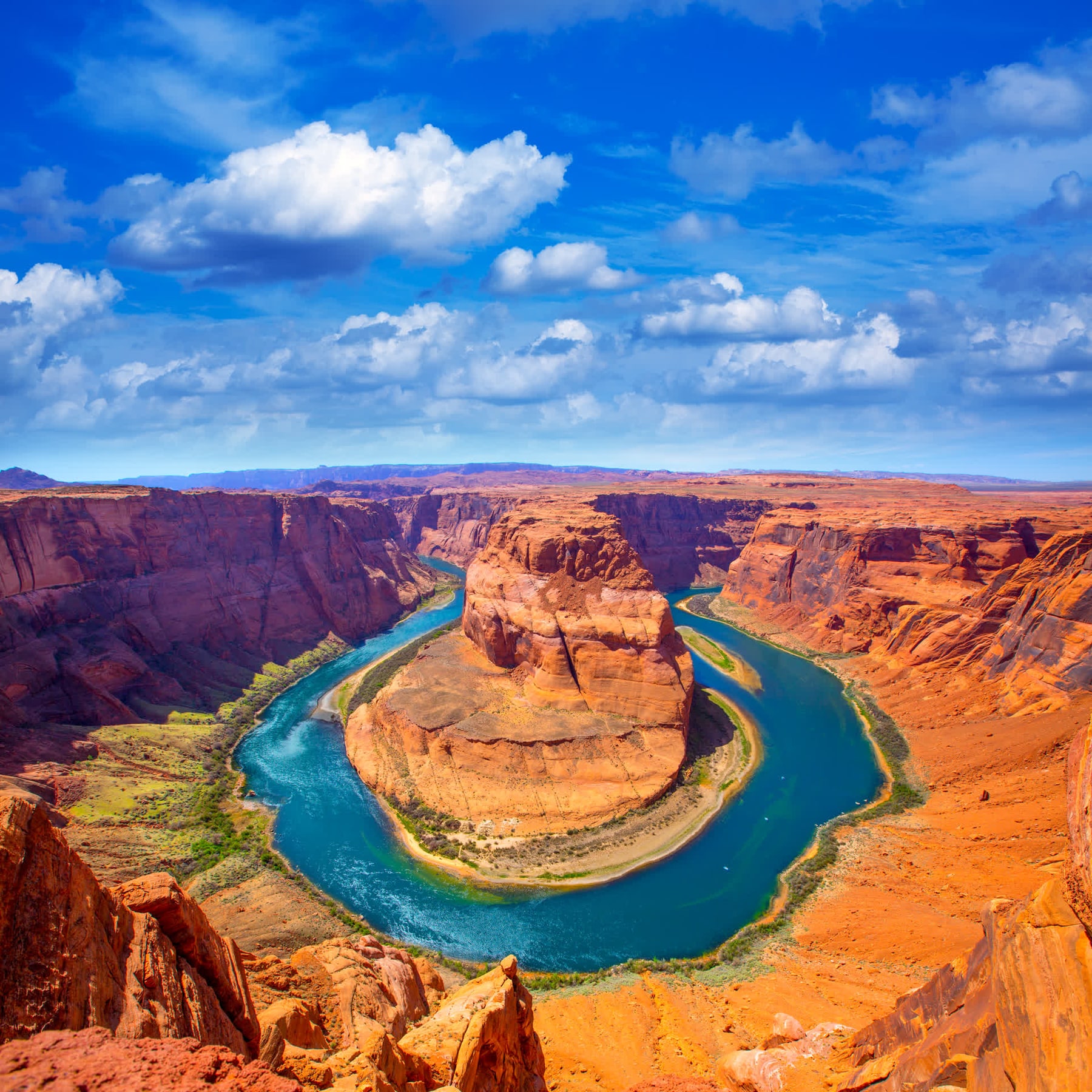
I have visited Horseshoe Bend multiple times, and the scale still works on me. The overlook is familiar before you arrive because it has appeared on approximately every Arizona mood board ever created. In person, the Colorado River sits a thousand feet below and the sandstone changes color as the sun moves. The depth does not fit neatly into a screen.
I prefer sunset because the warm light and shadow pull more shape out of the bend. I also appreciate the newer hardened trail, shade structures, and viewing platform. They make the visit more manageable, but they do not make every inch of the rim protected.
The hike and accessibility
The route is about 1.5 miles round trip on a wide hardened path. It is designed to be accessible, but heat, grades, sand at the edges, and distance still matter. Two shade structures sit along the route, not at the overlook. Review current access for individual mobility needs.
Parking fee and passes
The City of Page operates the parking area and currently lists fees starting at $10 per passenger vehicle. National park passes do not cover this municipal fee. The site is open from sunrise to sunset, and payment methods may differ on holiday weekends. Prices can change, so carry a payment method and do not park along Highway 89 when the lot is busy.
Sunset, sunrise, and crowds
Sunset is colorful and crowded; sunrise is cooler and often calmer. Arrive early enough to walk before the light you want. After sunset, use a light for the return and expect a concentrated departure. Midday in warm months is exposed and offers very little mercy.
Edge safety and weather
A railing protects the main viewing platform, but much of the rim remains unguarded. Stay well back from edges, supervise your group, and avoid sandstone margins in high wind or storms. Carry water; none is available on the trail.
Photo tips
A wide lens helps include the full river curve, but phone panorama or ultra-wide mode can work. At sunset, tap the bright sky and lower exposure slightly. Drones are prohibited. The strongest image still comes from a stable, legal position rather than stepping closer to improve a composition by three percent.
The short version before you leave
Check current parking and access information, carry water, avoid peak heat, and stay behind barriers. Give yourself time rather than forcing the overlook into a rushed drive-by.
Go prepared. Follow the rules of the place. Leave with the story, not part of the landscape.
Questions people actually ask
Before this becomes twelve open browser tabs.
How long is the Horseshoe Bend hike?
It is approximately 1.5 miles round trip. Most visits take one and a half to two hours, longer for sunset or photography.
Is there a parking fee?
Yes. The City of Page currently lists fees starting at $10 per passenger vehicle, and federal recreation passes do not cover it. Larger vehicles use different rates.
Is Horseshoe Bend accessible?
The main route is wide and hardened and was built for improved accessibility, but distance, heat, grades, and conditions may still present barriers.
What time is best?
Sunset offers dramatic color and crowds; sunrise is cooler and quieter. Avoid peak afternoon heat in warm months.
Is the entire overlook fenced?
No. The central viewing platform has a railing, but much of the rim is unguarded. Stay back from all edges.
Can I fly a drone?
No. Drone launching, landing, and operation are prohibited at the site under current rules.
Are there restrooms and water?
Restrooms are available near the parking area. There is no water on the exposed trail or at the overlook, so carry enough for the round trip.
Can I bring a dog?
Leashed dogs are allowed on the main trail under current rules. Protect paws from hot ground, carry water, clean up after the dog, and never allow a leash to create an edge hazard.
Keep planning here
One stop down. Northern Arizona remains enormous.
Sources checked for this Travel Guide
These sources support factual, historical, and access information.
- National Park Service Horseshoe Bend visitor guidance
- City of Page parking and access information
- Shannon’s multiple visits
Hours, fees, roads, water, weather, and closures can change. Confirm time-sensitive conditions with the official operator or land manager before traveling.